I went to Ladakh on a trip from 31st August to 8th September and did the Sham trek on 6th and 7th September. The Sham Valley Trek is a 3-day trek that runs from Likir to Yangthang to Hemis and then to Temesgang Nurla. We converted it to 2 days with a plan to go from Hemis to Yangthang and then to Likir. The Hemis to Yangthang leg is around 8 kms and take 4 hrs (took us longer with all our adventures). The Yangthang to Likir leg is 10 kms and takes around 6 hours (we managed it in slightly less than 5, Woohoo!). We planned to do the trek towards the end of our Ladakh trip so that we were better acclimatized to the higher altitude levels. This is how the trek went:
On day 1, we drove from Leh to Yangthang and dropped off our baggage at the home-stay where we would spend the night, then we drove to Hemis Shukpachan. After visiting the monastery, our driver Rinchen took us to the starting point of our hike from Hemis to Yangthang. The hike began and the conversation was constantly showered with useless tips from my dad like take small steps, don’t have sweets, etc. Some of his points were useful though, such as breathe deeply. The initial part was a steady climb and after finishing that bit we had lunch in the shade of a rock.
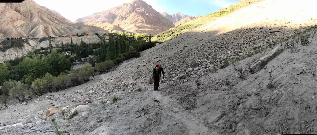
Following the path may be the right thing to do but it is not always fun. We learnt this the hard way. After lunch, we took a short cut but somewhere along the way got off the trail and ended up at a point among the mountains where the only way to continue was to sit on our behinds and slide down the mountain. This way led us to the back of a lone farm house. Thankfully we found some farm workers and were led back by a woman named Dolma who was one of the workers in the farm and also ran a small out of the way guest-house.
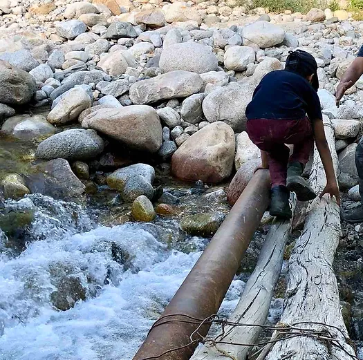
The route she took us by included crossing a narrow river crawling on a bridge made of two bamboos and an iron pipe. Then, she took us on was a steep climb and we were exhausted by the time we finished the climb. The Ladakhi I had picked up over our stay helped and my parents offered Dolma some money for her help. She took us up a mountain which we now call Lenta Ascenditur (which means tough climb in Latin) and showed us the way to Yangthang.
After I regained my sense of humour I suggested that we find a picture of the mountain we climbed and throw darts at it. Of course, this experience led to a heated discussion between my dad and me about getting a guide for the next day. But, we settled on a solution of asking our driver to meet us at key points of the trek where we crossed the car route to give us directions. Suggested: Have a map with a route marked so you can use it when you are at a T–junction or fork. There are also some nice mobile apps which give information for treks all around the world.
We had a relaxing evening at the homestay. Some other travellers from Netherlands, who were also doing the Sham trek, let me take a look at a very detailed Ladakh map which I pored over for a while. Our driver had brought chicken which the people at the homestay cooked for us. It was a very delicious dinner and we all slept well.
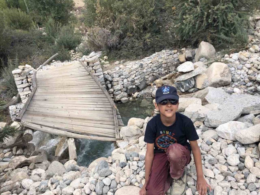
Day 2 was a slightly longer trek going from Yangthang to Likir. We started our hike laughing and joking around as we went. Our driver had pointed out our trail and said he would meet us later along the way. It took us 50 minutes to an hour to complete this leg of the trail full of climbs and descents and we had much fun. Our driver gave us another round of directions which led us to a village with a very crooked bridge over a fast-running stream. We created a game in which you look for trail markers of different colours and whoever spotted them first would call out the colour. It was good fun and we enjoyed this leg. Right after we reached the village we met a local who was plucking apricots she warned us about a bridge we would be crossing after the village. She also gave us a few apricots which we had been plucking and eating throughout this trip. It was walking bridge to cross the river, part of it was damaged and bent due to flooding in the river a few days back. My dad offered to go first but was stopped by both my mother and me. My mother took the lead, I followed and my father took the rear. I suggest going single file and one at a time in these situations.
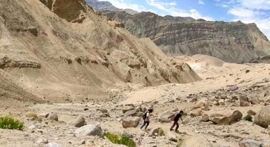
After crossing the bridge, we got some more directions from our driver had a snack break and headed for the second last leg of the trek. This was the longest leg which began gently and ended steeply, very steeply. As we trekked, closely following our driver’s directions, we met another hiker who was coming from the other direction, he told us about a shortcut and suggested we don’t take it as it was too steep. Needless to say, we took the shortcut. To me that same mountain looked like a crocodile lazing in the mountain sun. After successfully climbing the crocodile we hiked through a gorge where we met another group of female hikers who marvelled at the fact I was hiking too. After the gorge, we reached an area in which we could either use a very steep path or climb rocks till the paths intersected. If you have read enough of my blogs you would now we went with the rocks. It was fun to go over the rocks.
The final stretch of this leg was very steep. To push ourselves along, we decided to play a guestimate game. We decided it would be around 500 steps to the top. So, we would do 50 steps and take a break. In the end, it only turned out to be 400 and some change steps. Following that climb we finally reached the top from where we could see Likir and it was a short stretch. At Likir, I found a perfect tree branch to use as a walking stick which cheered me up.
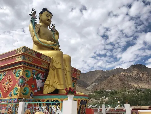
At last we reached the Likir Monastery which concluded our monastery to monastery trek. Our driver had brought us packed lunch which we ate in a restaurant outside the monastery. The lunch was sandwiches make of local Ladakhi bread: khambir. My parents liked the bread, me not so much as it was a little thick and hard. Anyways, we explored Likir Monastery, spun the prayer wheels and then drove to Dawa Guesthouse to unwind and spend the night. I suggest you take it easy and rest for a day after the trek to soothe your legs after all the walking.
Ladakh not only offers an amazing set of treks but also a brilliant site-seeing experience.
Here is a brief outline of other sites we visited:
– Hunder sand-dunes where you can ride camels and ski down sand dunes without ski (haha)
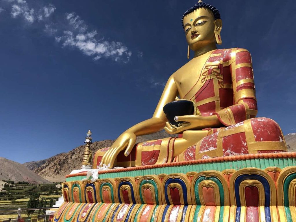
– The various monasteries or gompas as the locals call them. We visited the two Sham trek monasteries, and Diksit and Thiksey gompas.
– You can also visit the northern-most villages of India (Turkuk and Tyakshi) where you will be under Pakistani army surveillance.
– Rivers are everywhere; we saw the Sangam where Indus and Zanskar rivers meet. We also the Shyok river or Shock River as I called it as it was super cold.
– Beautiful lakes – we visited 3 of them. Pangong, Tso Moriri and Tso Kar. We stayed overnight in camps at the first two. We saw lots of wishing stupas which are built by piling flat rocks; people build them to make their wishes come true
Ladakh is hands down the most explorative vacation I have ever had except maybe Ireland Ring of Kerry*. For adventurers and vacationers alike, Ladakh will provide something to marvel at, be it the beauty of the rivers and lakes to the steepness of the mountains (Lenta Ascenditur for us). Ladakh will be fun for all. Juley*
*Juley is Bye, Hello, Thank You and Please in Ladakhi